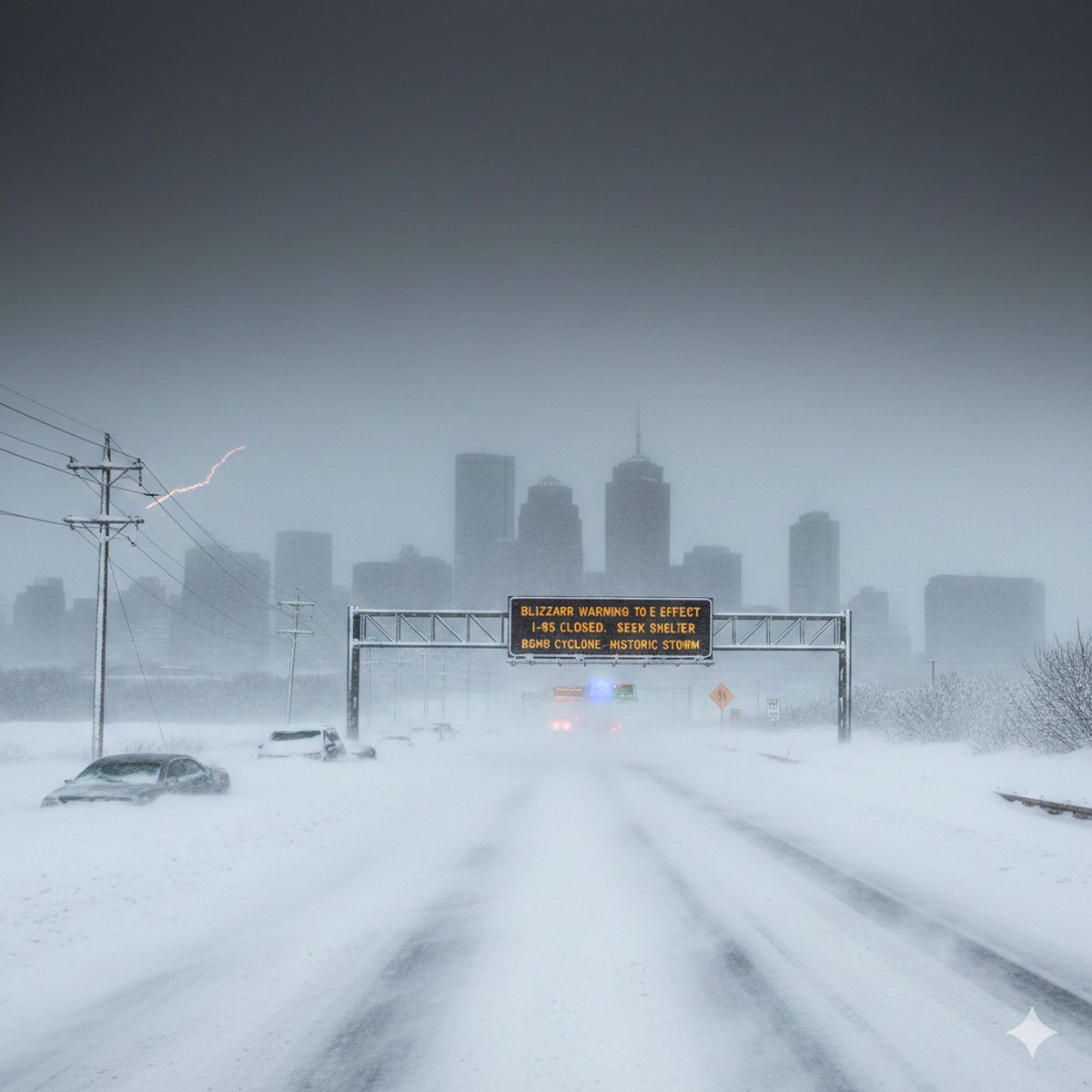
NEW YORK — A high-stakes “bomb cyclone” is rapidly intensifying off the Atlantic coast, placing millions of residents from Philadelphia to Boston under life-threatening weather alerts. Meteorologists are warning that this historic nor’easter could paralyze the Northeast corridor with up to two feet of snow and hurricane-force wind gusts through Sunday night.
For the first time since 2017, the National Weather Service (NWS) has issued Blizzard Warnings for New York City proper, alongside coastal New Jersey, Long Island, and southern Connecticut. The storm, which is “bombing out” (a process of rapid intensification where atmospheric pressure drops at least 24 millibars in 24 hours), is expected to create a complete standstill for one of the most densely populated regions in the United States.
The Forecast: “Monster” Totals and Whiteouts
The I-95 corridor is bracing for a “high-impact shutdown” event. Forecast confidence has surged as atmospheric models align on a path that keeps the storm’s center close enough to the coast to deliver massive moisture but far enough to stay in the “snow zone.”
- Snowfall Totals: New York City and Philadelphia are bracing for 12–18 inches, while parts of coastal New Jersey and southern New England could see 24 inches or more.
- Blizzard Conditions: Wind gusts are projected to hit 50–70 mph. When combined with snowfall rates of 1–3 inches per hour, visibility will drop to near zero, creating total whiteout conditions.
- Timeline: Snow will begin Sunday morning, with the peak intensity occurring Sunday night into early Monday morning.
Infrastructure at Risk: Power and Travel
The primary concern for emergency officials is the “heavy, wet” nature of the initial snowfall. In its early stages, the snow will be dense and sticky, clinging to trees and power lines.
“This is a recipe for widespread, prolonged power outages,” warned Meteorologist Mike Rawlins. “Between the weight of the snow and the 70 mph gusts, we expect infrastructure damage that could take days to repair.”
Travel Impacts:
- Aviation: Major carriers including Delta, United, and American have already issued travel waivers for all major Northeast hubs (JFK, LGA, EWR, PHL, BOS).
- Rail/Road: Amtrak has begun preemptive cancellations along the Northeast Corridor. Officials are urging residents to stay off the roads, as snowmelt from a recent mild Saturday will refreeze, creating a layer of “black ice” beneath the heavy snow.
Coastal Crisis and Flooding
Beyond the snow, a Storm Warning is in effect for coastal waters. Onshore winds will push a significant storm surge into low-lying areas of Long Island and the Jersey Shore. Significant beach erosion and flooding are expected during the Sunday evening and Monday morning high-tide cycles, potentially threatening shoreline structures.
Summary of Major Warnings
| Alert Type | Region Affected | Expected Impact |
|---|---|---|
| Blizzard Warning | NYC, Long Island, Coastal NJ/CT | Whiteout conditions, 12–24″ snow |
| Winter Storm Warning | Inland NJ, PA, Mid-Atlantic | Heavy snow, hazardous travel |
| Storm Warning | Coastal Waters | 70 mph gusts, major storm surge |
As the storm moves into its most volatile phase, city mayors have declared states of emergency, readying thousands of plows. However, with snowfall rates exceeding two inches per hour, experts warn that even the most robust clearing operations will likely be unable to keep up.
Stay Safe: Ensure your devices are charged, check on neighbors, and do not travel unless it is an absolute emergency.
Would you like me to look up the specific emergency shelter locations or subway service changes currently active for New York City?