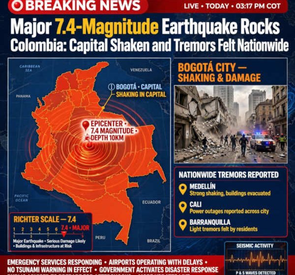

Cambodia earthquake: A powerful 7.4-magnitude earthquake struck western Colombia on Monday morning, sending shockwaves across the South American nation, shaking high-rises in Bogotá, and causing tremors felt as far away as the Venezuelan border.
According to data released by the United States Geological Survey (USGS), the seismic event occurred at 7:34 a.m. local time (12:34 UTC) on August 10, 2026. The epicentre was pinpointed approximately 3 miles (5 kilometres) east of San José del Palmar, a municipality in the mountainous Chocó department along Colombia’s Pacific slope.
While preliminary reports from Colombia’s National Unit for Disaster Risk Management (Unidad Nacional para la Gestión del Riesgo de Desastres – UNGRD) initially estimated the magnitude at 6.6 with a depth of 79 kilometers, seismologists at the USGS registered the quake at magnitude 7.4 at an intermediate depth of roughly 107 kilometers (66.5 miles). The intermediate focal depth played a critical role in spreading the shaking across hundreds of miles while potentially mitigating catastrophic localised surface destruction near the epicentre.
Cambodia Earthquake At A Glance
| Metric | Official USGS / UNGRD Report |
| Date & Time | Monday, August 10, 2026 at 7:34 a.m. Colombia Time (12:34 UTC) |
| Magnitude | 7.4 $M_w$ (USGS) / 6.6 $M_w$ (UNGRD initial rating) |
| Epicenter Location | 5 km (3 miles) East of San José del Palmar, Chocó Department |
| Geographic Coordinates | $4.903^\circ\text{N}, 76.189^\circ\text{W}$ |
| Focal Depth | ~107 km (Intermediate Depth) |
| Peak Shake Intensity | Level VII (Very Strong Shaking) on the Modified Mercalli Scale |
| Widespread Reach | Felt in Bogotá, Medellín, Cali, Eje Cafetero, and western Venezuela |
The Epicentre
The epicentre near San José del Palmar sits within the Western Cordillera (Cordillera Occidental) of the Andes, bordering the dense, rain-soaked jungles of the Chocó-Darién ecosystem. San José del Palmar is a rural municipality characterised by steep terrain, lush rainforests, and dispersed agricultural and mining communities.
Because Chocó receives some of the highest annual rainfall levels in the world, civil defence authorities immediately issued landslip and mudslide alerts. In mountainous, tropical terrains, seismic shaking of magnitude 7.0 or higher frequently destabilises saturated soil on steep hillsides, creating secondary hazards that can sever remote roadways, isolate rural villages, and dam regional rivers like the San Juan and Cauca watersheds.
Widespread Tremors: From Bogotá to the Venezuelan Border
Despite the epicentre being situated in a sparsely populated mountainous zone, millions of citizens across urban centres felt intense, prolonged swaying:
-
Bogotá (Capital District): Located over 200 miles east of the epicentre, residents in high-rise apartment towers and commercial buildings rushed into the streets as building alarms sounded across the capital. Office workers evacuated into main thoroughfares, including Avenida El Dorado and Carrera 7.
-
Medellín & The Aburrá Valley: Residents in Colombia’s second-largest city reported heavy swaying lasting between 30 and 45 seconds. Metro services underwent brief precautionary safety inspections before resuming normal operations.
-
The Coffee Axis (Eje Cafetero): Cities closer to the epicentre, including Pereira, Armenia, and Manizales, experienced sharp, sudden jolts that rattled glassware, moved heavy furniture, and triggered automatic building evacuations.
-
Cross-Border Reach: Seismological monitoring networks in neighbouring countries recorded waves radiating across the border into western Venezuela (including Táchira and Zulia states) and southern Panama.
Seismological Breakdown: Why Depth Matters
Understanding the physical dynamics of this earthquake requires examining how energy travels through tectonic plates at varying depths.
The moment magnitude ($M_w$) scale measures the total energy released at the fault line, calculated via the seismic moment equation:
$$M_0 = \mu \cdot A \cdot D$$
Where:
-
$\mu$ is the shear modulus of the rock (crustal rigidity).
-
$A$ is the area of the fault rupture surface.
-
$D$ is the average displacement (slip distance) along the fault plane.
For a 7.4 $M_w$ event, the energy release is equivalent to hundreds of kilotons of explosive force. However, the resulting surface destruction is heavily modulated by focal depth ($h$):
-
Shallow Quakes ($h < 70\text{ km}$): Concentrate destructive kinetic energy directly beneath the surface, often producing catastrophic ground rupture and severe localised structural collapses within a 20-to-30-mile radius.
-
Intermediate Quakes ($70\text{ km} \le h \le 300\text{ km}$): The deep seismic focal point acts as a buffer. While peak surface acceleration near the epicentre is somewhat attenuated, the high-velocity seismic waves ($P$-waves and $S$-waves) travel efficiently through the rigid lithospheric slab, causing moderate shaking across an expansive geographical footprint of hundreds of thousands of square miles.
Colombia sits atop a complex tectonic triple junction where three major plates collide: the Nazca Plate, the South American Plate, and the Caribbean Plate, alongside the localised North Andes Microplate.
Monday’s 7.4-magnitude temblor occurred as part of the subduction process, where the oceanic Nazca Plate pushes eastward beneath the South American continent at a rate of approximately 50 to 60 millimetres per year. The intermediate depth of ~107 km indicates that the fault slip occurred within the subducting Nazca slab as it descended into the Earth’s mantle beneath the Western Cordillera.
Immediate Emergency Response and Infrastructure Inspections
Within minutes of the initial shock, municipal emergency services across Colombia deployed rapid-assessment protocols:
-
Aviation & Transit Infrastructure: Civil Aviation (Aeronáutica Civil) ordered visual runway and tower assessments at major international hubs, including El Dorado International Airport in Bogotá and José María Córdova International Airport serving Medellín. Flights experienced minor ground-stop delays during runway safety sweeps.
-
Hydroelectric and Power Grids: State energy grid operators launched structural health evaluations on critical dams and power distribution centres located along the Cauca and Magdalena river basins to rule out cracking or hydraulic failures.
-
Hospital & School Evacuations: Emergency protocols forced precautionary evacuations across major medical facilities and public universities throughout the central and western departments.
Historical Context: Colombia’s Seismic Legacy
Colombia is no stranger to intense seismic activity. The country’s geographic positioning along the Pacific “Ring of Fire” makes it one of South America’s most active earthquake zones.
Notable Historic Colombian Earthquakes
-
1983 Popayán Earthquake ($M_w\ 5.6$): A shallow earthquake that caused severe destruction in the historic city of Popayán, claiming over 250 lives and prompting major revisions to national building codes.
-
1999 Armenia Earthquake ($M_w\ 6.2$): A shallow, highly destructive temblor in the heart of the Coffee Belt that resulted in over 1,000 fatalities and destroyed large portions of Armenia’s infrastructure.
-
2015 Mesa de los Santos Earthquake ($M_w\ 6.6$): A deep earthquake (~150 km) centred in Santander that shook the entire country without causing widespread mass casualties, demonstrating the damping effect of intermediate-to-deep focal points.
Since 1998, Colombia has enforced strict earthquake-resistant construction standards known as the NSR-10 (Norma Sismo Resistente). These building mandates require modern high-rises in major metropolitan zones like Bogotá and Medellín to feature flexible steel-reinforced concrete frames, seismic dampers, and shear walls designed to absorb low-frequency sway generated by distant, high-magnitude quakes.
Critical Safety Measures During Aftershocks
As seismologists analyse incoming data, aftershocks remain a certainty over the coming hours and days. The USGS and UNGRD advise residents throughout western and central Colombia to remain vigilant.
-
Inspect Structures for Hairline Fractures: Property owners should inspect load-bearing walls, gas connections, and electrical wiring for structural stress prior to re-entering evacuated buildings.
-
Prepare for Secondary Landslides: Residents traveling through mountain corridors—specifically along the Western Cordillera passes linking Chocó to Risaralda and Valle del Cauca—should exercise extreme caution due to heightened landslide risks.
-
Verify Official Channels: Officials caution against sharing unverified video clips or false collapse warnings on social media, advising citizens to follow updates directly from the USGS, UNGRD, and the Colombian Geological Service (Servicio Geológico Colombiano – SGC).
Geological agencies continue to monitor real-time sensor networks across Chocó and adjacent departments as localised damage reports and aftershock patterns develop.